Publication Plan April 2024
Ended on the 31 May 2024
Appendix B
Strategic masterplanning location proformas
|
Site reference |
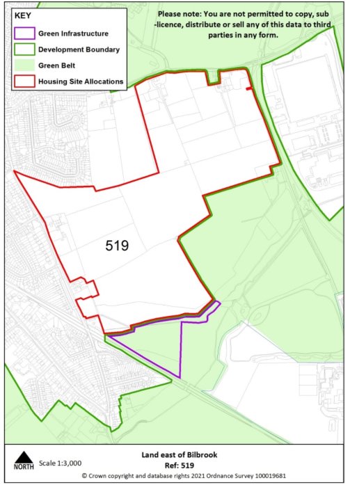
519 |
Village |
Bilbrook |
|
Minimum capacity |
750 dwellings |
Address |
Land east of Bilbrook |
|
Site area |
39.6 ha |
Proposed use |
Housing-led mixed use |
|
|
|||
|
Site infrastructure and access requirements |
To deliver site in accordance with site specific requirements and master plan process set out in Policies MA1 and SA1. |
||
|
Site reference |
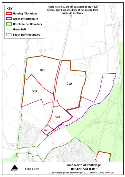
420, 584 & 010 |
Village |
Penkridge |
|
Minimum capacity |
1029 dwellings |
Address |
Land north of Penkridge off A449 and Lower Drayton Farm |
|
Site area |
51 ha |
Proposed use |
Housing-led mixed use |
|
|
|||
|
Site infrastructure and access requirements |
To deliver site in accordance with site specific requirements and master plan process set out in Policy MA1 and SA2. |
||
For instructions on how to use the system and make comments, please see our help guide.
Share on:


