Publication Plan April 2024
(2) Appendix E
Employment allocation maps and proformas
|
Site reference |
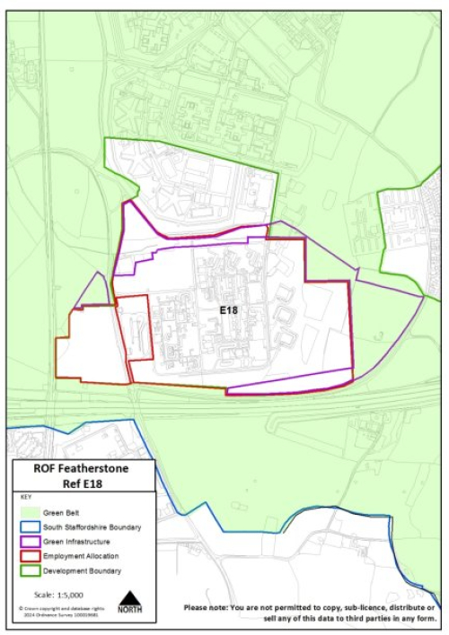
E18 |
Address |
ROF Featherstone |
|
Location |
Featherstone |
||
|
Site size |
36 |
Proposed use |
E(g); B2, B8 |
|
|
|||
|
Site access requirements |
Access utilising road permitted through previous outline consent (20/01131/OUT). |
||
|
Site reference |
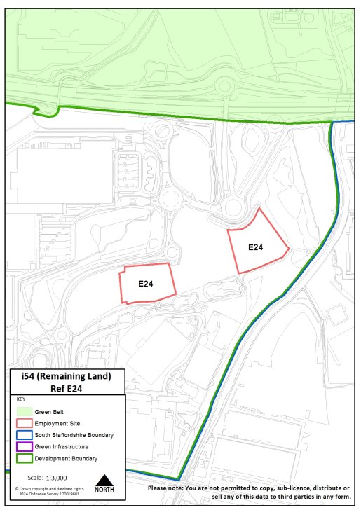
E24 |
Address |
I54 (remaining land) |
|
Location |
Bilbrook |
||
|
Site size |
2.4ha |
Proposed use |
E(g); B2; |
|
|
|||
|
Site access requirements |
Access through the existing business park (Innovation Drive). |
||
|
Site reference |
E30 |
Address |
M6 Junction 13, Dunston |
|
Location |
Dunston |
||
|
Site size |
17.6ha |
Proposed use |
E(g); B2; B8 |
|
|
|||
|
Site access requirements |
Access via the A449 |
||
|
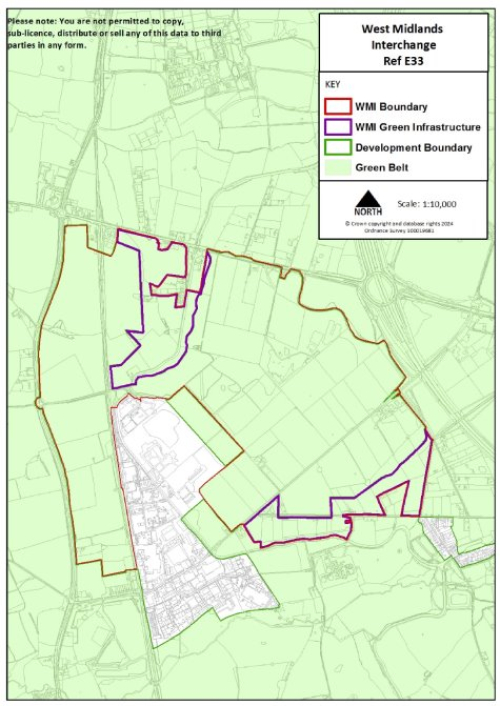
Site reference |
E33 |
Address |
West Midlands Interchange |
|
Location |
Gailey |
||
|
Site size |
297ha |
Proposed use |
B8 |
|
|
|||
|
Site access requirements |
The sites infrastructure and access requirements are set out in the Development Consent Order (DCO) for the site. |
||
|
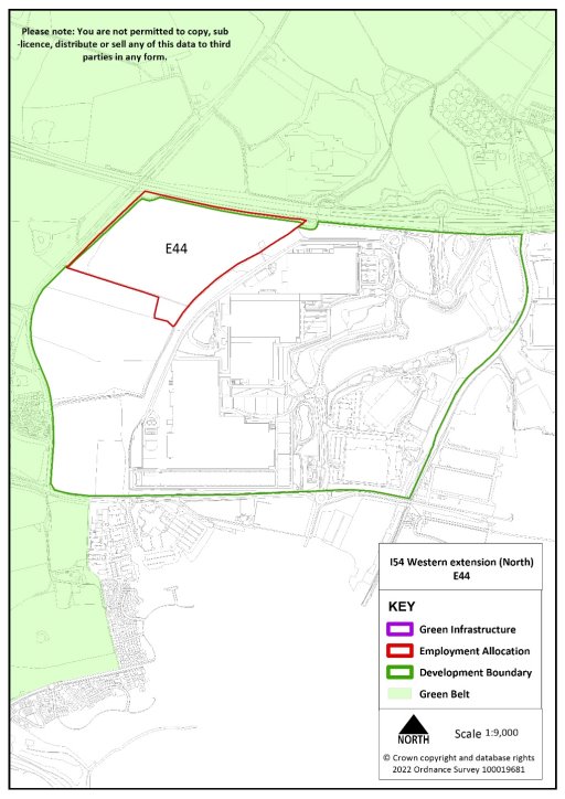
Site reference |
E44 |
Address |
I54 western extension (north) |
|
Location |
Bilbrook |
||
|
Site size |
16.7 |
Proposed use |
E(g); B2 |
|
|
|||
|
Site access requirements |
Access through existing i54 business park utilising access permitted through previous outline consent (18/00637/OUT). |
||