Publication Plan November 2022
Appendix B
Strategic masterplanning location proformas
Site reference
519
Village
Bilbrook
Minimum capacity
848 dwellings
Address
Land east of Bilbrook
Site area
39.6 ha
Proposed use
Housing-led mixed use
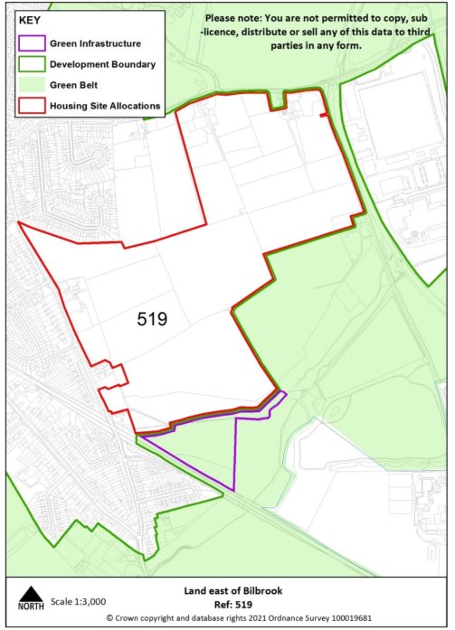
Site infrastructure and access requirements
To deliver site in accordance with site specific requirements and master plan process set out in Policies MA1 and SA1.
Site reference
486c
Location
North of the Black Country
Minimum capacity
1976 dwellings (1200 dwellings by 2039)
Address
Land at Linthouse Lane (Essington Ward - adjoining City of Wolverhampton Boundary)
Site area
94.1ha
Proposed use
Housing-led mixed use
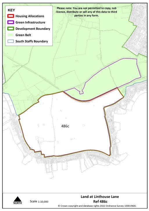
Site infrastructure and access requirements
To deliver site in accordance with site specific requirements and master plan process set out in Policies MA1 and SA3.
Site reference
420, 584 & 010
Village
Penkridge
Minimum capacity
1129 dwellings
Address
Land north of Penkridge off A449 and Lower Drayton Farm
Site area
51 ha
Proposed use
Housing-led mixed use
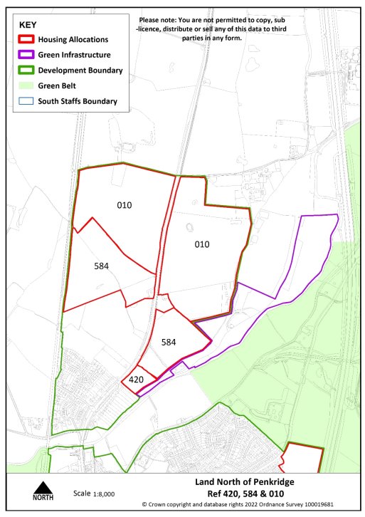
Site infrastructure and access requirements
To deliver site in accordance with site specific requirements and master plan process set out in Policy MA1 and SA4.
Site reference
646a&b
Location
North of the Black Country
Minimum capacity
1200 dwellings
Address
Land at Cross Green (Brewood and Coven Ward)
Site area
54.3 ha
Proposed use
Housing-led mixed use
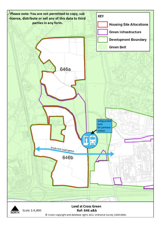
Site infrastructure and access requirements
To deliver site in accordance with site specific requirements and master plan process set out in Policy MA1 and SA2.


